Thursday, November 30, 2006

Waterfall on North Deep Creek: Shore-Styers Mill Nature Park

Water Colors Photo Copyright © 2007 G. Kiser

Tucked away near East Bend, NC, in Yadkin County, you will find a very impressive waterfall considering how far East you are. Not too far off of US 421 is the site where several mills used to be located. Finding the location is easy enough. Take the Shacktown Exit (Exit 253) from US 421 and turn North onto Old Stage Rd. You will quickly come to a "T" intersection where you will turn left onto Shacktown Rd. After only 0.3 of a mile you will come to Styers Mill Rd where you will turn right and continue for almost a half a mile. Just before a bridge you will see a gravel parking area. The falls can be seen from the parking area.

This is one of the few waterfalls I have visited where the observation deck gives a very good view of the falls and is a good location for pictures. Even though the falls are only 12 feet high, the amount of water that passes over the rocks is enough to categorize this as a full blown waterfall. The watershed is plentiful, so you should expect good flow any time during the year.
Even though the observation deck is well placed, you owe it to yourself to venture down to the falls for a closer look. There are several paths leading down to the banks of the stream. There are plenty of rocks scattered throughout the water, but if you want to cross to the other bank, be prepared to get wet. At the most shallow point, you are looking at knee level water for at least half the trip across. The rocks are not that steady either, so if you are trying to rock hop, beware, you could end up off balance and laying in the stream...not speaking from experience, of course.


What Lies Beneath

Once down at stream level, you will unfortunately see the evidence of those that visit here. There are beer cans, water bottles, and believe it or not I've even seen a pair of underwear in the grass. There was also a good amount of graffiti that detracted from the natural beauty. This is a shame and impacts not only the environment, but those trying to enjoy it as well. When you are visiting these amazing natural wonders, please be sure you leave it in the same condition as when you got there.

Once you get past the evidence of littering and vandalism, you might find some rock-wall remains by the falls. These are from the mills that have operated here in the past. There is not much left, but memories and some stone work. Yadkin County has purchased the land and has made it a historical park. You can read more about the Shore-Styers Mill Nature Park at http://www.shore-styers-mill.org/.

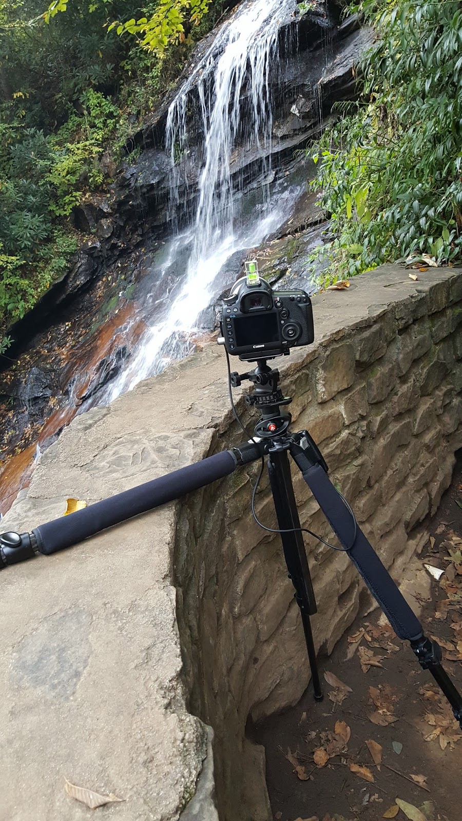
I was skeptical about this waterfall after reading about it, but I must say, this waterfall should be on your must see list.  I have been several time now, and each time the vandalism gets a little bit worse, and the trash seems to pile up.  However, the waterfall remains worth a visit.  It is beautiful!  From a photography standpoint, your best bet will be isolations of the different elements of the falls.  These will provide more dramatic photographs than the typical "postcard shot" which includes the entire waterfall.

Tuesday, November 7, 2006

Waterfalls Along Anthony Creek

Anthony Creek Tributary Photo Copyright © 2006 G. Kiser

Nestled in the back country of Caldwell County about 10 miles South of Blowing Rock in Watauga County, there is a small mountain creek that is fed by several small waterfalls. These can be seen along Anthony Creek Rd. Finding this can be a little difficult, or at least it was for me. All my directions were based on the numbered state roads and included directions like, turn at the church. I'll try and simplify these directions here so you may have an easier time locating these waterfalls.

As you leave Boone, NC, towards Blowing Rock, NC, on Hwy 321 you will come to the Shoppes on the Parkway. The light following the entrance is for Main St, where you will take a right. You will wind through Blowing Rock until you come to a very small residential street to the right. Turn onto John's River Rd which becomes an unpaved washboard surface after about a half mile and change names to Globe Rd. For the next eight miles you will continue on this unpaved road (term used loosely). In the first four miles, you will loose nearly 2,000 feet of elevation, so make sure your brakes are working properly, and use low gear. At the end of the road, you will come to a "T" intersection at Globe Rd Baptist Church. You will turn right and continue on Anthony Creek Rd until it too turns to an unpaved surface. Keep your eyes out at this point because there are several small waterfalls to be seen.  These really are small, and barely enough to be considered waterfalls.

According to Kevin Adams, the waterfall to see, is the one pictured above. It can be found on the right of the road about three miles from when the gravel started. To be quite honest, I was expecting much greater things by his photograph and description. This is about a 50 foot tall slide that ends in a cascade at the base. It is nice, but not worth a special trip to see. The waterfall that caught my eye was about two miles before you even get to this waterfall.

Under the Arch Photo Copyright © 2006 G. Kiser

If you are not paying attention, you might pass right by this particular cascade. From the picture, you can see that the water is well hidden among the rocks, but I saw promise in it. With a little hiking up the boulder path, you will come to the top and see two distinct waterfalls side by side along with a few other sizeable cascades.

This is to the left...

Water Slalom Photo Copyright © 2006 G. Kiser

and this is to the right...

Rushing Past the Rocks Photo Copyright © 2006 G. Kiser

None of these water features are very large with the tallest single element less than 20 feet tall, however the intricacies of how the water flows around the rocks and other natural barriers is quite interesting. While these waterfalls might not be enough to lure you out into the backwoods, the drive itself is very pleasant. You will pass Christmas Tree Farms, old houses, lots of farm land, and several quaint churches. You are drawn back to a simpler time, but it is best experienced with a good 4WD vehicle with plenty of ground clearance.

There are several other small waterfalls out here that I have not photographed, mainly because of very poor lighting. There are others that are on private property, and I refuse to trespass for the sake of a picture. This entry will be updated as I collect more information on the waterfalls of Anthony Creek.

Friday, September 22, 2006

Linville Falls: From the Plunge Basin Overlook

Enter the Basin

The Linville Falls area is just North of the Linville Gorge along the Blue Ridge Parkway. You can find this attraction at milepost 316.5 on the Blue Ridge Parkway, South of the Linn Cove Viaduct. A second trailhead can also be located off of Kistler Memorial Highway (Old NC 105) off of NC 183. To view the Linville Falls, your best bet would be the former which is where the visitor's center is.

Once in the parking lot, you will find the visitor's center with a map of the park, and some pictures of the waterfalls. You will find the trail head near this building and will hike 0.2 miles before you come to fork in the path. To get an aerial view of the Linville Falls, take the right fork and proceed another 0.3 miles. You will come to a series of steep stairs leading to the stone walled observation deck. From here you are able to look down into the Plunge Basin. While this is not a perfect view of the falls, it really gives you an idea of the magnitude of the land you are currently inhabiting.

To get closer to the falls, you would need to have taken the left fork, heading to the base of the falls. I have not taken that path as of yet, but will do so in the near future. A separate entry will be made for each of the observation locations of the many falls, and views in the Linville Falls area.


  • Update 07-11-2007--I have completed all the trails at Linville Falls. For information about the left fork that leads to the bottom of the Gorge, please click here.

From a photographer's point of view, this overlook is probably the least productive in the whole park.  It is a nice hike, but the end results will likely leave you wanting more.  I would suggest taking any of the other trails before you go down this one.  It does offer a unique view of the falls, but there is really only one composition available from this point.  Oh, and since the trees have grown up a bit, I would suggest that you climb on top of the rocky wall on the side of the overlook.  It is wide enough to stand on, and to mount a tripod.  It will clear the visual path effectively as well.

Wednesday, September 20, 2006

The Cascades at E. B. Jeffress Park

Shrouded in Greenery

E. B. Jeffress Park is located on the Blue Ridge Parkway in North Carolina at milepost 271. There is ample parking for the park, and you will also find an overlook with plenty of picnic tables set up. There is a short self guided trail that winds through the woods to a waterfall, known only as the Cascades. There is not much written about this particular waterfall, and few are really impressed with it. I have now been several times and have enjoyed it each time.

As the trail comes to the falls, you will find an observation deck lined in stone. To their credit, this actually does flow with the surroundings contrary to lots of wooden observation decks that are used. This top deck affords a reasonable view of the top of the waterfall. There is really nothing special about this location. However, if you continue down the stone steps, you will come to another stone lined observation deck. This gives you a splendid view of the main attraction of the falls. From here you can see the water cascading from the upper water slide to the lower one. This is my favorite element by far of this waterfall.

The observation deck is nice, but to really photograph the falls, the photographer needs to move to a different location. There is a worn trail just off the side of the observation deck that leads down the slope of the falls. Even in the best of conditions, this is a dangerous trail and care should be taken. For a completely unimpeded view, there is a downed tree stretching across the lower water slide. It is worn on top, I'm assuming from spectators sitting. It is a great place to take in the beauty, but I just wasn't that brave, or foolish.

For photographing the falls, I would suggest a point about a third of the way down from the observation deck. There is a slight opening in the trees where a great shot awaits. The branches naturally frame the important parts of the falls, and composition is almost a no brainer.  Just be very careful of your footing as the rocks are slick, and you won't recover from this fall.

After getting that perfect shot, don't pack all the gear up. There is still a return hike that goes along the stream that feeds the falls. There are some great views along this stream, and something worth taking your time to explore.
Old Mossy Log Photo Copyright © 2006 G. Kiser

Update: 07-06-2008

After completing my third visit to the Cascades I have a few things to report back about. The first and most important change is that the trail to the lower overlook has seen some repairs. In years past, the railings have been missing, allowing the curious hiker the ability to go off-trail along a well worn path. This path, which led to a very nice viewing point, was quite dangerous as I mentioned above. After the recent death of a child at Chimney Rock State Park, this makeshift trail has been closed off. It is probably for the better as this slope was very steep and the chance of getting hurt was pretty significant.

The other change that I would like to make to the original entry is that the upper overlook is not that bad after all. While not really showing the major part of the waterfall, it does have its merits. Depending on the water flow on the day you visit, you will probably be able to see some very nice small cascades as the water begins its run down the water slide portion.
The Origin

Update: 11-20-2016

I have returned to the Cascades after many years away.  The lower portion of the trail is still closed off, and has grown over which indicates that most people are following directions.  The amount of brush that has developed there would make photography nearly impossible, so it is a good thing that the upper section has some very interesting portions.  I have learned that the best pictures of this waterfall do not have to include the entire thing.  Actually, that would be rather impossible with how tall the falls are.  However, it is so very tempting to try and photograph as much of the waterfall as you can.

Tranquility
As you can see, by filling the frame with a 70-200mm lens, you can get some striking photos
of this waterfall.  The flow was kind of low this day, but it really made for a much better picture than if the water was just pouring off the ledge.  Getting the angle right is the hardest part.  As you can see here, you might be better off using a bean bag to support the camera.  I ended up just laying one of my tripod legs over the observation wall while supporting the camera on the remaining two legs.  This worked out wonderfully, and allowed me to get that perfect sense of motion in the water.

Unfortunately, there are not too many options for compositions, or at least locations for you to shoot.  There are two different observations points.  and that is really all you have to work with.  It is still a well worth it waterfall if for no other reason than it is close to the Blue Ridge Parkway, and only a very short and easy hike to get to.

Monday, September 18, 2006

Dugger's Creek Falls: Linville Falls


Serenity Cove
The Linville Falls area is just North of the Linville Gorge along the Blue Ridge Parkway. You can find this attraction at milepost 316.5 on the Blue Ridge Parkway, South of the Linn Cove Viaduct. A second trail head can be located off of Kistler Memorial Highway (Old NC 105) off of NC 183. To view Dugger's Creek Falls, your best bet would be the former which is where the main visitor's center is.

Once in the parking lot, you will find the visitor's center with a map of the park, and some pictures of the waterfalls. To see Dugger's Creek Falls, you will just need to follow the edge of the parking lot back to the street. You will come upon a small, marked trailhead to your right. Once you enter the woods, you will follow a very short trail to a bridge over Dugger's Creek. The falls will be to your right. While this is not a large waterfall by any stretch, it is probably one of the most interesting in the park. The way it sits in the woods, it almost begs to be photographed. If you are lucky, and can hold your breath to keep the swinging bridge from moving, you can get some great shots from the bridge itself. There is also a trail going down below for other views of the falls.


Hope Springs Eternal
When you hear people talk about the Linville Falls, you will rarely hear them mention this particular one. There are much more impressive falls in the park, but none that have the same quaint quality as this one. It is also on the shortest and easiest trail...you have no excuse not to see this one, except for periods of low rainfall.  This is one of those that will dry up very quickly.  In the drought plagued months this is barely even a trickle.  After a good rain however, I would rank this waterfall among the prettiest views in the entire park.


Stone Mountain Falls: Stone Mt State Park

Stone Mountain Falls Photo Copyright © 2006 G. Kiser

Stone Mountain State Park is located in Roaring Gap, NC and is home to four waterfalls. This park is not too difficult to find thanks to signs from the major roads. Detailed directions can be found at their web site. For those coming from Hwy 421, you would want to exit onto I-77 North to Elkin. After you pass Elkin, you need to branch off to the left onto US 21. The next turn will be a left onto Traphill Rd (SR 1002), followed by a right onto John P. Frank Parkway. The Parkway will take you into the park.

Once to the park gate, you will follow the main road to the first parking area to the left. There will be a marked trail that winds its way along a small stream and through a field. Of interesting note, there are often deer along this field. They don't seem to be too apprehensive about people, but they sure don't like the sound of a camera bag opening. Anyway, you continue along the trail until you come to a split. On the right will be the Stone Mountain Loop Trail, a strenuous hike, but with a wonderful view of the summit. To the left you will find a trail leading to the falls. After a short distance you will come upon several warning signs advising of the dangers of the rocks, and that there have been deaths in the past from accidents. Do be careful, as the rock floor is not the best surface to walk on.

You have made it to the top of Stone Mountain Falls. You can see the water pouring down the rocky slope and then disapearing below. This is only the beginning, to really see the falls for what they are, you must climb down around 300 steep steps along the side of the water slide. According to Kevin Adams in his book North Carolina Waterfalls, A hiking and photography guide, the steps were built over several months at a cost of $100,000. After climbing up and down these steps, I think the smarter decision would have been to put in an escalator, or elevator for a few dollars more. These steps are a necessary evil as they provide a safe passage from top to bottom of the falls.

I would suggest an alternative route, however.  To avoid the hellish stair climber feature, I would suggest going to the main parking area/trailhead.  From here you will follow the marked trail for the Stone Mountain Loop Trail.  The signage is a little confusing, but you are going for the middle trail ultimately.  You will start off by taking the right fork going toward Wolf Rock Trail.  You will follow the access road leading the Hutchinson Homestead for a ways.  You can also see the rock outcropping for which the park is named.  Continue on this trail and you will come to another split.  Take the left split this time...away from Wolf Rock.  You will pass the Cedar Rock Loop Trail as well as the trail to the Lower and Middle Falls.  You will end up at the base of the Stone Mountain Falls.

Stone Mountain Falls, is classified as a water slide, because the water just flows down a very steep slope. Towards the bottom, there is some diversions to its path which add a little interest, but for the most part this is a very plain waterfall. It is also very difficult to get a full shot of the location because you are shooting up into the sky. As I quickly discovered the trip down the steps was not a wasted trip by any stretch. As in most of the locations I shoot, there is usually something else in the area that is oftentimes overlooked.

 Rocky Seat Photo Copyright © 2006 G. Kiser

Just a short distance downstream from the Stone Mountain Falls you will find sections of the stream that I think are much more interesting than the main falls. This is a very active stream with lots of rocks in the path of the water creating white water effects. Access to the stream is very simple and for the most part, you are walking right along side of it while on the trail.

This is a visit once type of waterfall though.  It is impressive for its size, but lacks a lot of character that can be found in most other waterfalls in the state.

***UPDATE, 12-04-2010***

Stone Mountain Falls

After putting off a return trip to this waterfall for some time, I finally decided to give it another try.  One thing that I would like to start out by saying is beginning the hike at the main trailhead in the lower lot is the way to go.  It is a rather simple hike from this direction and doesn't include nearly as many steps as coming from the other side.  I happened to visit in the winter and had a surprise snow event which worked out great for photographs.  I also applied another waterfall techniqe to this waterfall which worked very well.  I picked out a segment and isolated it.  As you can tell from the 2006 photograph, most of this waterfall is just a straight drop with no real drama.  Add to that the fact that you have to include the sky and it is not a pretty waterfall to photograph.  However, if you isolate the bottom section, you will have a change in direction, as well as some foreground interest.  In this case, the snow covered trees and rocks gave the perfect setting for the image.

While I still am not all that fond of the waterfall, under the right conditions, and with the right frame of mind a decent photograph can be taken here.

Widow's Creek Falls: Stone Mt. State Park

Widow's Creek Falls
Stone Mountain State Park is located in Roaring Gap, NC and is home to four waterfalls. This park is not too difficult to find thanks to signs from the major roads. Detailed directions can be found at their web site. For those coming from Hwy 421, you would want to exit onto I-77 North to Elkin. After you pass Elkin, you need to branch off to the left onto US 21. The next turn will be a left onto Traphill Rd (SR 1002), followed by a right onto John P. Frank Parkway. The Parkway will take you into the park.

To get to Widow's Creek Falls, enter the park and continue on the main road. You will pass the main parking for the Stone Mountain trail head on your left. Start to pay attention to the pull off parking on the right because you are almost there. The gravel parking area is small, but marked with a sign for the falls.  There is room for about three to four cars which give you an idea of how many people actually visit this waterfall.  After parking you will need to follow a short and level path for about 120 feet until you can see the Widow's Creek Falls.  Actually, if you are visiting in the winter months, you can just about see the falls from the parking pad.

This waterfall comes from a small watershed, so the best times to view it are after significant rainfall. This is a very serene waterfall with outcroppings of rock all around. There are several locations by which you can view this waterfall. The closer you get, the more dangerous the conditions are. Please keep in mind that the smooth rock that you will be walking on can be slippery at times and can change without warning. Be sure to wear very good boots for traction and ankle support.  I have had a few moments here where I understood how the waterfall received its name.  I wouldn't recommend doing your own personal research into the matter.

This waterfall is of particular interest because of what looks to be caves in both the face of the waterfall, and in the rock wall to the left of the falls. From certain angles, the face of the waterfall looks very much like a....well, face. It is interesting to me how the water splits into two cascades which run parallel down the rocks into a very still pool of water. From here the water flows over the smooth rocky floor down a slope, into a larger pool. This waterfall has many facets to explore.

For those wanting to photograph this waterfall, you will find that exposures can be a bit on the tricky side.  The rocks are bleached and very bright against the wet sections which appear a good deal darker.  Your best bet on these falls would be to go on a deeply overcast day, while it is misting, or has just finished raining.  Having the rocks wet will improve your chances for a good photograph.  Don't be afraid to try compositions from both sides of the falls as the flow of your photograph will change significantly from one side to the next.

 Bullhead Creek

When you have finished your exploration of the Widow's Creek Falls, don't be too eager to pack up and head to the next stop. Be sure to cross the road and check out the stream which runs along the side of the road. It is a very typical mountain stream with rocky obstructions that cause sections of white water to appear. This stream continues for a very long distance and there are several places in which you can find some very pretty rapids. The photograph above is about a half mile from the waterfall.

Update 02-05-2008

I have now been to Stone Mountain several times and have seen all of the waterfalls in the park. Widow's Creek Falls is by no means the biggest, or a central attraction in the park, but I would have to say if you could only see one waterfall here, this would be it. Ironically, it is the easiest to get to, and requires the least amount of work to enjoy. Another benefit is I have rarely seen more than two or three people there at a time. In the summer months, there are likely to be dozens...even hundreds at the Stone Mountain Falls, and a good many sunning themselfs at the other two in the park. For just simple enjoyment of nature, Widow's Creek Falls is the one to visit.


Friday, September 15, 2006

Tory's Falls: Hanging Rock State Park

New Life

You will have to travel a little bit around the boundaries of Hanging Rock State Park to view this waterfall, but it is well worth the trip (depending on the recent rains). The park itself is located off of NC 8 North of Hwy 52 in Danbury, NC. A complete set of directions and a map can be found on their website. Once to the park, you will turn onto Moore's Spring Rd which is right before the entry gate to the park. You will continue a short distance until you reach Hall Rd. Take the left and follow Hall Rd for a little over two miles until you come to Mickey Rd. Turn left onto Mickey Rd, and then left again on Charlie Young Rd. You will see a parking area on your left.

There are two trail heads in this parking area. To view Tory's Falls, take the upper trail for approximately 300 yards. You will come to a split in the trail that is marked with a sign. Follow the sign to Tory's falls. The observation area is an outcropping of rocks just off of the trail. You can work your way to the edge of the rocks to get a decent view of the tallest falls in the park. The top section is about 50 feet tall, but it has a very long trail of cascades below that run an addition 150 feet or so. You will be tempted to venture to the forest floor to find a better vantage point to see the lower sections of the falls. If you are able to do so, please let me know. I have looked and looked for a way to get down there. Actually, I have found lots of ways down, but could not see a way back up. Everything I have read says that it is not possible to venture lower in safety without proper climbing gear.


Tory's Falls

In order to really see Tory's Falls at its best, you must go shortly after a heavy rainfall. Otherwise, you will only see a trickle flowing over the rocks. This is an impressive waterfall if only for its shear length. The route the water takes is incredible.

For those that wish to photograph this waterfall, you will have two choices available to you...first, you can pick out isolated sections of this waterfall with a telephoto lens. This works well as there are many portions of this waterfall that make great compositions. Your other choice is to use a wide angle lens which will allow you to capture much more of the falls. Trust me, you will never capture the entire waterfall with one shot. It actually goes further than you can see through the trees below. Again, it is important that there be lots of rain in the days preceding your shoot, or you will likely be very disappointed.

This is another waterfall that benefits from the chill of winter.  There are lots of chances for shots of the frozen mist, as well as icicles coming off of the rocks.  These are best done through isolation shots because of the size and distance of the waterfall.  If you have the ability to shoot up to 200mm you should be fine.  There is much more to be found in the 300-600mm range as well.


Hidden Falls: Hanging Rock State Park

The Hidden Falls
I'll have to admit, that the first time I visited the Hidden Falls located at Hanging Rock State Park in Danbury, NC, I was not that impressed. The second time I visited, I was less impressed. So why did I go back for a third time? Well...you see, it is directly off of the path that leads you to the Window Falls which I have attempted to photograph many times. I can never convince myself to save the few steps and bypass the Hidden Falls. I'm glad I didn't. I've since changed my mind about this particular waterfall.

Hanging Rock State Park is located off of NC 8 North of Hwy 52. For a map and directions, visit their web site where you can download a map in either JPEG or PDF format. Once in the park, you will park at the visitor's center and proceed along the hiking trail by the picnic shelters. This hike is an easy 0.4 mile from the pavement. Just 0.2 of a mile more, and you will be at the Window Falls.

At the Hidden Falls, you will pretty much be at the end of a short trail. It is a very secluded location, and I have seen only a few people here in the times I have visited. This is not a grand and powerful waterfall, and only stands about 40-45 feet tall. The beauty of this fall is more tied up in the atmosphere of the location rather than the spectacle. Each time I visit, I am reminded of those water trickling decorations that you find on office desks and home corner tables. It is just enough noise to drown out the white noise around you, but still quite enough that you can hear the inhabitants of the woods around you. It can be extremely relaxing to just sit with your eyes closed and to listen.

I really think the season plays a large part in the beauty of this particular waterfall. I had been in Fall and Winter previously. The colors were drab, and lifeless. On the third trip, I chose to visit in the Summer. This is not normally a good time for waterfalls as the water levels are low. The Hidden Falls does not really have a large amount of water flowing over it's rocks to begin with, so the lower water levels didn't really affect the look of the falls. However, the color in the surrounding vegetation really brought the scene to life for this photographer and elevated it to one of my favorites falls in the park.

There is a lot to this waterfall, and I do plan on returning to it several more times.  I think that working on some isolations will provide some great images, asd something a bit different than the normal full shot.  I would also like to mention that because of the slow waterflow here it makes for a great icy winterscape when the temperatures drop below freezing for long enough.

Cascade on the Rocks

Wednesday, September 13, 2006

Behind the Window Falls:Hanging Rock State Park

Silent Lucidity

The background of the Window Falls, at Hanging Rock State Park, has been discussed previously, so I won't bore you with the directions and such in this entry.  I felt that this particular cascade deserved its very own entry. While you are hiking around the Window Falls, you will find a path leading to the ledge at the very top of the falls. It does not look like anything special, so most will pass it by. However, it is very much worth the climb.  I would caution you that the rocks can be slippery so take care when you are ascending to find this bonus cascade.

Above the Window Falls you will find two features. The first is a large hole in the rocky wall that gives the falls its name. It looks just like a window, and is a natural formation. I don't have any pictures of this, because the hole just doesn't hold that much attraction for me. However, you can see pictures of the window at ncwaterfalls.com. Just scroll down a bit and you will see what I am talking about.

The subject that grabs my attention above the Window Falls is another small waterfall. It is tucked back almost in a cave of sorts. The mountain to the right provides a wall (complete with window by the way) and a ceiling above. To the left, and immediately behind the cascade is open, covered only by trees. This gives the site a very cozy feel, but is a photographer's nightmare when it comes to photographing in the deep shadows.

The End of Winter Photo Copyright © 2006 G. Kiser

Turning around from the small cascade, you can see a splendid view of the park. This picture shows the top of the Window Falls off to the right. You can kind of get an idea of how the shadows work in this pseudo cave, which I am still standing in for this picture.

Window Falls: Hanging Rock State Park

Window Falls
Window Falls is located within the Hanging Rock State Park which is located in Danbury, NC off of NC 8, north from Hwy 52. More specific directions can be found on their official web site. Window Falls is probably the most visited waterfall in the entire park. As you can see from the picture, there is an opening behind the falls that is easily accessible. I have seen many a hiker cool off in the spray of this magnificent feature.

Finding the Window Falls is fairly easy, although takes a bit more of a hike than the other falls in the park. Once inside the park, you will park by the visitor's center. On the side of the parking lot, you will see picnic benches and shelters set up just beyond the trash cans. There will be a sign that says to Window Falls, and Hidden Falls. Just follow the trail for 0.6 mile which is an easy stroll for the most part. As you get close to the falls, you will have to climb down some steps. These steps have been cut into the rocky ground, so they are not as uniform as those in your house. They are easily traversed, but will add to the difficulty of the hike. This section would be classified as moderate mainly due to the hike back up.

Once you finish with the steps you will find yourself at an observation platform. From here, you can see the water gently falling off of the ledge. Like I said previously, this is a frequently visited location so if you are going to attempt any photography, you will have to be flexible while folks enjoy the view, and cool off in the warmer months.  I would strongly suggest getting here early in the morning, or waiting until the cooler months if your goal is to capture a picture or two.

You can leave the observation platform and explore in the woods a bit. For those that choose to do so, they will be richly rewarded with some secondary cascades below the main water fall. It takes some maneuvering to make you way through the thick woods, but there are several vantage points to view the cascades.


Lower Window Falls Photo Copyright © 2005 G. Kiser

Don't pack up just yet. There is more to see around this particular waterfall. All you have to do is climb up, and you will find even more to look at. For details, please read the sister entry Behind the Window Falls: Hanging Rock State Park.

The hardest part of this hike comes after you are done taking in the beauty of the falls. The stairs that you came down, become rather tiresome on the way back up. It is a good workout to be sure. It is on these return hikes that I question the 40LBS of gear I am carrying with me.

Edit 09-30-2009

The lower sections of this waterfall have gotten much more grown up since my visit in 2005.  I have tried to find similar compositions to the one posted here, but there is just to much ground clutter now.  I would recommend not going beyond the trail because there is little to nothing there to see anymore.


Upper Cascades Falls: Hanging Rock State Park

A Melody Visualized

Tucked well within Hanging Rock State Park you will find several different waterfalls, one of which is the Upper Cascades Falls.  It is one of six named waterfalls found here.  To get to the park, you can download a map (either JPEG, or PDF) from their web site. It is located along NC 8 in Danbury, NC.

Once inside the park, follow the main road to the parking area by the visitor's center. There are trails on either end of the parking lot, but to see the Upper Cascades, you must cross back over the road you just drove in on. The trail head is marked, and the trail is an easy 0.2 mile which leads to an observation deck. As with most waterfalls, the better views are slightly off of the deck.  You can access the base of the waterfall where you will find yourself standing on the rocky boudaries of the basin.

In my opinion, this waterfall is not quite as nice as the others in Hanging Rock. It is more of a water slide, where the water cascades slowly down the steep mountain side. These are not my favorite types, but is worth a look if you are in the park. Try to go when the water levels are up so the amount of water flowing is more impressive. Judging from the surrounding scenery, Autumn would be the time to visit this particular waterfall.


Edit 09-23-2007

I still stand by my original opinion that this is not one of the best falls that Hanging Rock has to offer, however, after this last trip, I will say that I like it a bit more than I had remembered. Being the easiest hike to a waterfall in the park, this is a good visit for those that would like to see a waterfall, but don't want to hike far to get there. The best views are still afforded from the ground level which is just a few flights of stairs below the trail. Once at the bottom, you can get as close to the waterfall as you would like to. After cascading down the falls, the water takes a lazy path to a second drop, which you can see in the photo above. This takes a bit of maneuvering to get to, and is not worth the effort unless you just want a picture.

Since this waterfall is very easy to get to, be aware that during peak seasons, it will serve you better to start early. By 10-11am you will be joined by families, and other hikers.  If your intention is quiet enjoyment, you will undoubtedly be disappointed.

Edit 01-27-2010

My opinion has once again changed about this waterfall.  On this most recent visit, I went right after a series of heavy rains.  The water levels were up well above normal and there was a lot more water flowing over the rocks.  For the first time, this waterfall looked more like a cascade and less like a simple waterslide.  With a heavy water flow this waterfall can be quite impressive and brings it up among the best ones in the park to visit.  However, without this boost in water, the waterfall is less than exciting.  An added note is that the best time to photograph this waterfall seems to be in the early morning hours on an overcast day.

Edit 09-15-2017

I have heard about another waterfall that was located below the Upper Cascades, but until recently I had not been able to find it.  It does take a little work to get to, but it is worth the trip.  You will need to be prepared for a scramble down an often muddy hill to get to it.  Fortunately, the climb back up is easier than the descent.  It is a small little waterfall, but it does lend itself to some interesting photographs.

Golden Nugget
To find the access path, you will need to look to the left of the trail as you are leaving the Upper Cascades.  As the trail goes flat after the boardwalks, you will see a place where the vegetation has been trampled just a little bit.  Look for places where the slope has been worn away.  There will be a boulder field to the left at the bottom.  That is where you want to be.  Once you scramble down the hill, you will cut to the left and work around the large rocks.  You will then see this small waterfall.  To my knowledge, it is not a named waterfall, but it is worth a look.  It does tend to stay in the shade for a long time in the morning which makes photography quite easy as you don't have to wait for a cloudy day.

I would also like to point out that this waterfall has a lot of intimate details that make it a great subject for isolations.

Nature's Movements

Lower Cascades Falls, Hanging Rock State Park

Serenity Pool

Hanging Rock State Park, located in Danbury, NC is home to six waterfalls, and is probably the overall best location for viewing multiple falls near the Piedmont area of the state. The park itself is very easy to find with directions on their web page as either a JPEG or PDF download. Basically, you just follow NC 8 North from Highway 52 until you see the signs.

The Lower Cascades Falls is just barely inside the park on the Northern boundary. Just before you get to the main gates, you will see Moore's Springs Rd to the right. Take that turn, and follow it to Hall Rd where you will turn left. A small parking area is on the right and is marked giving notice of the falls. Once you park, you will have a 0.3 mile hike to the falls. This is an easy hike through a reasonably well maintained trail.  You will not have any problems bringing the family along on this hike.

Once you get to the falls, you will see several observation decks and stairs leading to the base of the falls. You can see the Lower Cascades Falls from any of the observation platforms, but I strongly recommend that you go down the steps to the base. It is here that you can truly see the power of this beautiful waterfall. You can walk right up to the cascades as long as you are willing to do a little creative stepping.  The pool is also calm enough that you can wade in it.  It seems to be about waist deep for the most part once you actually get in it.

The waterfall is not the only spectacular sight here. Be sure to look around, because downstream of the falls, about 100-150ft there is another cascading stream. The personality of this stream changes with the amount of water. I've seen it a bare trickle, and a full-on white water experience. I find this hidden treasure to be just as beautiful as the Lower Cascades Falls, and well worth the look.


The Lone Leaf